


Waldens Ridge Voting District, Marion County, Tennessee
About
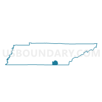
Outline

Summary
| Unique Area Identifier | 669210 |
| Name | Waldens Ridge Voting District |
| County | Marion County |
| State | Tennessee |
| Area (square miles) | 41.28 |
| Land Area (square miles) | 41.28 |
| Water Area (square miles) | 0.00 |
| % of Land Area | 100.00 |
| % of Water Area | 0.00 |
| Latitude of the Internal Point | 35.13885250 |
| Longtitude of the Internal Point | -85.43359050 |
Maps


Graphs
Select a template below for downloading or customizing gragh for Waldens Ridge Voting District, Marion County, Tennessee


Neighbors
Neighoring Voting District (by Name) Neighboring Voting District on the Map
- 067 Fairmount Voting District, Hamilton County, TN
- 5 Chapel Hill Voting District, Sequatchie County, TN
- 8 Loan Oak Church of God Voting District, Sequatchie County, TN
- Lusk Store Voting District, Marion County, TN
- Mineral Springs Voting District, Marion County, TN
- Powells Crossroads Voting District, Marion County, TN
Top 10 Neighboring County Subdivision (by Population) Neighboring County Subdivision on the Map
- District 2, Hamilton County, TN (37,111)
- District 4, Marion County, TN (6,178)
- District 5, Marion County, TN (5,869)
- District 5, Sequatchie County, TN (2,069)
- District 8, Sequatchie County, TN (1,529)
Top 10 Neighboring Place (by Population) Neighboring Place on the Map
Top 10 Neighboring Unified School District (by Population) Neighboring Unified School District on the Map
- Hamilton County School District, TN (336,463)
- Marion County School District, TN (27,274)
- Sequatchie County School District, TN (14,112)
Top 10 Neighboring State Legislative District Lower Chamber (by Population) Neighboring State Legislative District Lower Chamber on the Map
Top 10 Neighboring State Legislative District Upper Chamber (by Population) Neighboring State Legislative District Upper Chamber on the Map
- State Senate District 11, TN (188,547)
- State Senate District 14, TN (179,926)
- State Senate District 10, TN (176,153)
Top 10 Neighboring 111th Congressional District (by Population) Neighboring 111th Congressional District on the Map
Top 10 Neighboring Census Tract (by Population) Neighboring Census Tract on the Map
- Census Tract 602, Sequatchie County, TN (3,901)
- Census Tract 501.01, Marion County, TN (3,778)
- Census Tract 109.02, Hamilton County, TN (1,007)